
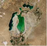
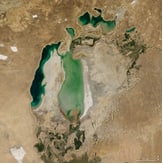
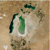
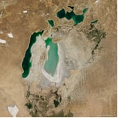
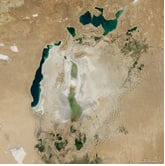
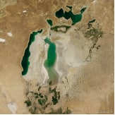
The name "Aral Sea" - from the word "Aral" - an island, connects with by the fact that the vast pool lies an island among the waterless deserts Turan lowland. The Aral Sea is located between Kazakhstan and Uzbekistan in the Turan lowland, in the deserts of Kyzylkum and Karakum, until 1960 the Aral Sea was the fourth largest drainless lake - the sea in the world, covered an area of 68.0 thousand km2 with a volume of 1000 km3 of water. From 1960 to 1990 in the Aral region large-scale programs for the development of new lands were carried out, in as a result of which the area of irrigated land doubled, reaching 7.4 million hectares, and the volume of water intake increased from 63 km to 117 km. AT As a result, by 1990, the flow of water into the Aral Sea sharply decreased from 56 km3 to 9-12 km3 per year. The sea level has dropped by 16m (from 54m to 38m), and the water surface area has decreased doubled, exposing the former bottom by more than 33 thousand km2.The sea is divided to the Northern (Small Sea) and Southern (Big Sea) parts. Level The Small Sea was stabilized due to the inflow from the river. Syrdarya, and the drying up of the Great Sea has become irreversible and it divided into Western (deep-water) and Eastern reach (dried in 2009). The sea has receded from its former shores in some places for more than 100-150 km. As a result of the removal of salts from the dried bottom of the sea salinization of the surrounding area occurred, thereby worsening the quality of arable land - 2.0 million hectares, the quality of water has deteriorated in lower reaches of the Amudarya and Syrdarya rivers.Decrease in volumes of releases in lower reaches of the rivers and water flow in the river led to an increase in the concentration salts in the water and the water became almost undrinkable. The active process of drainage and salinization of lands in the deltas continued rivers, as well as deep degradation of flora and fauna.


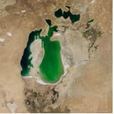
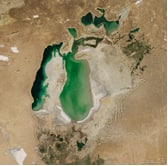
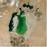
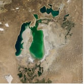
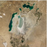
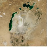
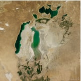
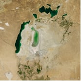
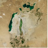
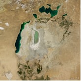
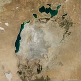
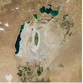

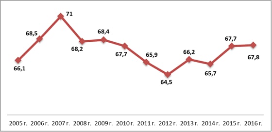
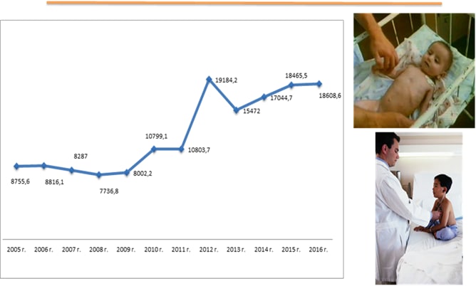
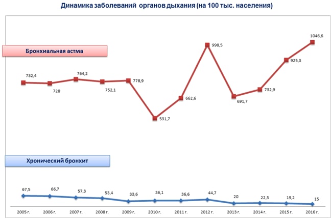
Water pollution and a large amount of dust and salt carried from the bottom dried up Aral, play a decisive role in the growth of morbidity people, general and infant mortality. The result was high indicators of a number of somatic diseases: anemia, kidney disease, gastrointestinal tract, an increase in the level of respiratory diseases, blood diseases, cholelithiasis, cardiovascular and oncological diseases.
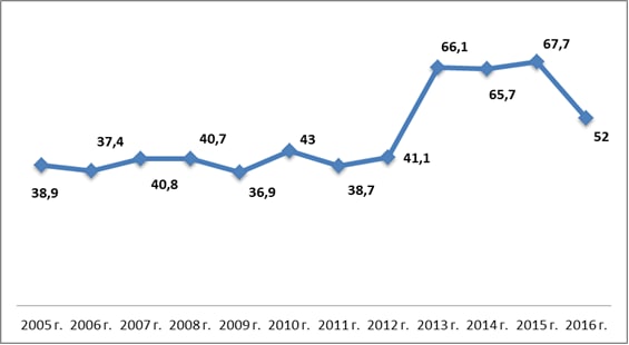
Particularly strong and rapid negative impacts are subject to children, which poses a particular danger to the gene pool of the population the Aral Sea region, and therefore the consequences will be irreversible. The content of dioxin in the blood of pregnant women and lactating milk mothers in Karakalpakstan is 5 times higher than in Europe.
The tragedy of the disappearance of the Aral Sea is one of the most convincing and vital
arguments against
unbalanced and unsustainable actions committed by the human race, which were
so much during the creative and at the same time destructive second half of the 20th century. For this
half a century, humanity has not only reached unparalleled milestones in technological development, but also
caused more damage to nature than ever before. This predatory violence upon the planet was caused
rapid technological revolution, which at one time was heralded as a turning point in
the history of mankind. This went on until the best minds discovered that behind her facade
there are very serious consequences.
This ambitious pursuit of mankind has caused almost all global climatic,
hydrological
and
geological changes (and not only in the former socialist countries), which manifested themselves in the
greenhouse
effect, loss of rivers, lakes and wetlands, and widespread desertification. unrestrained
the desire of people supposedly for their well-being, but in fact, mainly to increase their wealth,
domination and
ownership of property was eventually replaced by the understanding that everything in this world is
interdependent and
has its consequences,which manifest themselves as disturbances in natural processes and changes in
on an unprecedented scale. Some Western countries already in the 70s and 80s realized the need to “respect
nature and repay her debts", the USSR in these years was only beginning to think about environmental
problems and
came to insight only on the verge of its collapse.
Today, the peoples and governments of such countries should receive gratitude and
respect.
like Canada,
Holland, Switzerland and Japan, which give an example to all mankind how to restore their
relationship with nature. This can be seen from how urbanization is combined with the protection of fauna,
flora and landscapes in
the basis of harmonization of such conflicting interests as economic development, demographic growth, and
even
increasing natural potential in this process. Awareness of the partnership of man with nature, based on
deep respect for her and pride in natural wealth, is instilled from childhood and is derived from the
comprehension
his essence.
The shrinkage of the Aral Sea, which was a huge body of water with good quality water,
has reached
such
degree when
widespread degradation of nature inside the drying zone (below 53 m) as well as outside it
led to a situation in which the region is now characterized as a disaster area. Sea,
which served as a source of existence for rich flora and fauna and a natural regulator for the adjacent
irrigated
territory, falls into such decline, in which a desertification zone is formed, located between
deserts of Kyzylkum, Karakum and Ustyurt. On the former bottom of the sea, vast salt marshes appeared,
highly saline
earth, pockets of salt-dust removal.
In the coastal zone (above 53 m), the rock that formed over many years has completely
collapsed.
centuries
ecosystem
deltas and coastal strip, lakes dried up, water mineralization increased, in place of dried marshes appeared
salt marshes, the production of fish and fur-bearing animals has significantly decreased, migratory birds
have disappeared, are declining
flora and fauna, the local climate has undergone changes.
Five independent states - Kazakhstan, Kyrgyzstan, Tajikistan, Turkmenistan and
Uzbekistan -
located in the Aral Sea basin, correctly assessed the need to seriously address the problem of the Aral Sea
and Aral Sea (dried coastal zone). The heads of state approved the "Concept", which duly
a proposal is made to create a new sustainable anthropogenic-natural complex in the Aral Sea region,
designed
to restore the productivity of the territory to the highest possible previous level. However, due to
economic and social decline, the implementation of these plans is still facing constraints.
The current ecological situation worries people living in a swimming pool
Aral Sea,
so for
outside of it. As a result, many projects and project proposals have appeared, which are trying in one way
or another
otherwise address the following questions:
- protect the population from the impacts of desertification;
- create or restore the greatest possible biodiversity of flora and
fauna;
- create jobs for the local population by restoring fish farming,
muskrat breeding,
pasture
cattle breeding, processing industries, etc;
- create appropriate social and economic conditions for the local population
necessary for
raise
living standards through the introduction of new requirements for the management of water and land
resources;
- prevent further environmental degradation and restore
ecological
equilibrium
in
Aral Sea.
In the previous situation, these problems were solved through the hydrological regime of
rivers.
Amu Darya and
Syrdarya.
Socio-economic activity near the sea and in the deltas was closely tied to the regime of these zones and did
not
invaded natural conditions. In the current situation, it is necessary to return to the previous situation as
much as possible.
as far as possible and reverse the developing negative trends. Many donor organizations
tried to provide assistance to the "epicenter of the disaster", but no attempts were made to solve this
problem
using an integrated approach.And attempts in this direction have been made through the possibilities
the International Fund for Saving the Aral Sea (IFAS) and the GEF agency, which initiated a project to carry
out work on
restoration of wetlands (Sudochye project) and some small water bodies.
The history of the Aral Sea is controversial and unclear, despite the fact that the
study of it
many
folios, starting from the beginning of the last millennium, and from the second half of the 19th century,
the Aral became an object
numerous expeditions and works of the Russian Geographical Society and various scientific organizations
Russian state. The results of these works were summarized in 1908 by L. Berg in his famous work
"Essay on the history of the exploration of the Aral Sea", where he states that none of the Greek and Roman
there was no direct or indirect mention of the Aral Sea by the authors, but many of them talk about Oks
(Amu Darya) and Aksart (Syr Darya), it is not clear where they fell. According to the famous Khorezm
scientist
Al Beruni, who died in 1048, the Khorezmians leading their chronology from 1292 to the birth of Christ
testify to the existence of the Aral Sea. Berg makes the same reference to the sacred book of the Avesta,
where
there is an indication that the Vakhsh River or the current Amu Darya flows into Lake Varakhsha, under which
some
refer to the Aral Sea. The first more or less reliable sources about the existence of the Aral
the seas belong to the Arabic scripts, capturing the evidence of the conquerors of Khorezm in 712. These
data
are described in detail by V.V. Barthold, from which it is clear that already in the 800s the Aral Sea
existed, and it
was located not far from Khorezm, since its description completely coincides with the nature of the eastern
coast
Aral Sea. Other testimonies belong to Massudi ibn Nurusti, Al Balkhi and a number of others.
Arab writers and explorers-geographers.
Geological surveys that were carried out at the end of the 19th and at the beginning of
the 20th century (A.M.
Konshin, P.M.
Lesser, W.
Obruchev), boiled down to the fact that in the post-Pleocene era, part of the Karakum desert between the
Ustyurt chink on
in the north, by the mouths of the Murgab and Tejen in the south, in the west the soles of the Kopetdag were
flooded by the Great Aral.
The eastern half of the united Aral-Caspian Sea had, in their opinion, as the border of the former
Karakum Bay chink coastline Unguzov. This united sea covered a wide swath
of the modern Caspian region up to the foot of the western spurs of the Kopetdag and connected with the
Karakum and
Chilmetkum bays along two straits - Big and small Balkh. The Aral part was flooded into the same
period, the entire Sarykamysh basin and formed a bay up to Pitnyak, now occupied by the modern delta
Amudarya and the Khiva oasis (by the way, this explains the shor deposits near Pitnyak). Uzboy was a strait
connecting both of these water areas, but, obviously, its current form with large slopes was formed as
separation of the Caspian Sea from the Aral Sea and an increase in the difference in elevations between
them. During the subsequent geological
period to the present day, the united Aral-Caspian basin was divided into its constituent parts.
parts and its gradual reduction to the current limits. First there was a watershed between the
Aral-Sarykamysh
and the Caspian at Balla Ishem on the Ustyurt, then the Uzboy channel gradually became apparent. Drying
sequence
is confirmed by examples of transitional deposits from fresh cemeteries of Caspian mollusks (along the
Uzboy, in the sands
Chilmetkula, along the southeastern coast of the Caspian),covered with bare loose sands with weak and
young vegetation, to ancient formations in the central Karakum, transformed into blinkers, takyrs,
compacted sand mounds fixed by woody vegetation. Blinders as the lowest point
seabed, fed by pressure bitter-salty solutions, have preserved the appearance of ancient coastal lakes.
All researchers and historians since ancient times describe the transformation of the
Aral Sea and
Caspian in
dependencies
from the water content of the rivers of their joint basin and the development of irrigation. They state the
fact of final shrinkage
Sarykamysh from the end of the 16th century, when the Amu Darya no longer broke into Sarykamysh along the
Kunya - Darya and Daudan and
further along Uzboy. Uzboy from the Caspian Sea to the Balli Item watershed has a rise of 40 meters over a
length of more than 200 km. By
According to Obruchev, the existence of Sarykamysh took place from the 7th century BC to the 16th century.
Jenkinson in 1559 by
On the way to Khiva, he noted the presence of Sarykamysh, which he mistook for the confluence of the Oxus
into the Caspian.He also relies on
similar testimonies of Abdulgazi Khan, Gamdudla and other Khorezm chroniclers.
The Aral-Caspian lowland is depicted on more than a dozen maps, carefully
analyzed by René
Lethal and Monica Mainglo in their excellent monograph "Aral - Aral" (Springler - Verlag France, Paris, 1993
G.). Starting from the "Geography" of Ptolemy (II century BC), in which there is the Caspian in all its
grandeur, but no
no mention of the Aral (Fig. 1), through the scheme of Al Idrisi (1132) (Fig. 2), - where the Aral is
through
"Catalan Atlas" (1352) (Fig. 3) to Butakov's map, where the Aral Sea is already shown in the familiar form
(Fig. 4)
- the entire migration dynamics of the Aral Sea can be traced in human perception.
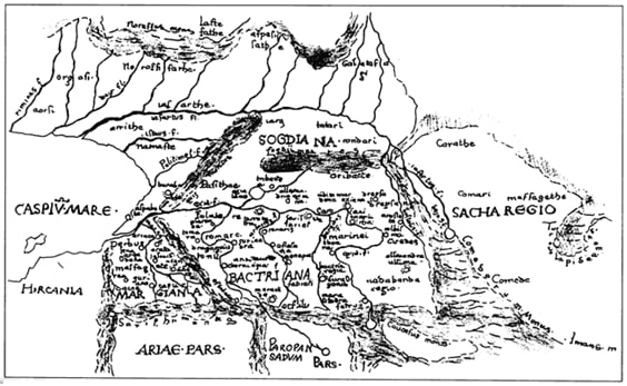
Picture. 1. Map from Ptolemy's Geography
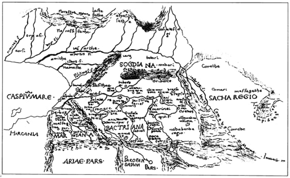
Picture. 2. Al Idrisi's scheme
Most researchers (B.V. Andrianov, A.S. Kes, P.V. Fedorov, V.A. Fedorovich,
E.G. Maev,
I.V.
Rubanov, A.L. Yanshin and others), based on geological and historical research, came to almost the same
conclusion,
well-formulated by N.V. Aladin: “in prehistoric times, changes in the level and salinity of the Aral had
place due to changes in the natural climate. During the humid climatic phase of the Syr Darya and Amu Darya
were full of water, and the lake reached a maximum level of 72-73 m.
In contrast to this, during the phases of arid climate, both rivers became low-water,
the level
Aral too
the degree of salinization of the Aral Sea region fell and grew. In historical time since the existence of
ancient Khorezm
level changes depended, to some extent, on climate change, but mainly on irrigation
activities in the region along both rivers. During periods of intensive development of the countries
adjacent to the Aral Sea, an increase
land irrigation led to the withdrawal of most of the water for this purpose, and the water level in the Aral
immediately
decreased.During unfavorable periods in the region (wars, revolutions, etc.), irrigated lands
shortened, and the rivers, and the Aral again filled with water.
Geological and hydrological surveys carried out by A.S. Kes and a number of outstanding
geographers in the 80s of the last century showed that the Amu Darya and Syr Darya, constantly changing
their routes and
migrating through the system of Central Asia in the historical period often did not reach the Aral Sea, the
Aral Sea
dried up, and on its territory a desert area was formed. At the same time, during the drying up of the sea
the salinity of the water rose sharply and contributed to the precipitation of salts, which were discovered
by geologists on
bottom of the Aral Sea. Large layers of mirabilite cages are especially striking. Migration of deltas of
both the Amu Darya and
The Syr Darya created a very peculiar territory of the lower reaches, in which depressions filled with
swamps
sediments, interspersed with a significant amount of desert, fine silt, sandy loam deposits, which
created a delta and most of the channel and channels of the Amu Darya. On the other hand, as evidenced
studies of zoologists, in particular Polishchuk, Aladin from the Zoological Institute of the USSR Academy of
Sciences in 1990,
The Aral Sea is distinguished by a very poor original fauna, many groups of animals are absent here,which
are developed in the Caspian Sea, which is close in origin. At the same time, in the Aral Sea there are
original
species, and all this indicates that salinization, which periodically occurred with the Aral Sea,
reflected in these enormous transformations.
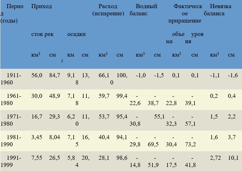
Table. Average long-term values of the water balance of the Aral Sea for certain periods
In terms of its size, the Aral was in fourth place among the lakes of the world: after
the Caspian,
Upper lakes of the North
America and lake Chad. The area of the Aral was 64,490 km2 (including islands); the greatest length is 428
km, the greatest
width - 284 km.
The lake was relatively shallow: the greatest depth was 68 meters; average depth -
only 16 meters.
The greatest depths are concentrated near the western coast in the form of a narrow strip; an area deeper
than 30 meters occupied
only about 4% of the lake.
So, the ancient Aral, which has undergone 5 or 6 transgressions - increases and
subsequent
desiccation - turned out again
on the verge of a new withering.
Although the disappearance of the Aral Sea is attributed to the Soviet state as the main
the culprit of this
natural and anthropogenic disaster, the idea of sacrificing the Aral Sea to the development of irrigation
and growth
agricultural production belongs to pre-revolutionary scientists. In particular, A.I. Voeikov (1908)
insisted that the existence of the Aral Sea with rational management of the economy is absolutely
unjustified,
since the economic effect of it (fish farming, maritime transport) is much less than the effect of
economic development and especially irrigated agriculture. the same idea in 1913.presents no longer a
scientist,
a
Head of the water sector of the former Tsarist Russia, Director of the Department of Land Improvements of
Russia Prince
IN AND. Masalsky, who believes that the ultimate goal is "to use all the water resources of the region and
to create a new Turkestan ... by introducing tens of millions of hectares of new lands to culture and
provide Russian
industry with essential cotton…».
For 1911-1960 the quasi-equilibrium state of the salt balance of the sea is
characteristic. Every year in
sea received 25.5 million tons of salts, the bulk of which was subjected to sedimentation when mixing sea
and
river waters (due to the oversaturation of the Aral waters with calcium carbonate) and was deposited in
shallow waters, in bays,
bays and filtration lakes of the northern, eastern and southern coasts of the sea. Thanks to the freezing of
the sea and
thawing, the average salinity of the sea during this period varied in the range of 9.6-10.3%. Relatively
large
the annual volume of river runoff (about 1/19 of the volume of the sea) determined a very peculiar salt
composition
Aral waters, differing from the salt composition of other inland enclosed and semi-enclosed seas by a large
content of carbonate and sulfate salts.
The modern period in the life of the sea, starting from 1961, can be characterized as a period of active
anthropogenic influence on its regime. A sharp increase in irrevocable withdrawals of runoff, reaching in
recent
years 70-75 km3/year, the exhaustion of the compensatory possibilities of rivers, as well as the natural low
water of two
decades 1960-1980 (92%) led to a violation of the balance of water and salt balances. For 1961-2002
gg. characterized by a significant excess of evaporation over the sum of incoming components (Only in 1998
did the inflow
29.8 km3 exceeded the evaporation of 27.49 km3). The inflow of river waters to the sea decreased during this
period on average in 1965
up to 30.0 km3/year, and for 1971-1980. it amounted to only 16.7 km3/year or 30% of the long-term average,
in
1980-1999 — 3.5-7.6 km3/year or 6-13% of the long-term average. In some dry years, the flow of the Amudarya
and
The Syr Darya practically did not reach the sea.
The quality of river flow has also changed. An increase in the proportion of highly
mineralized
waste and drainage water has led to a significant increase in mineralization and deterioration of the
sanitary condition
river waters. In dry years, the average annual mineralization of the Amudarya waters entering the sea
reaches
0.8-1.6, and in the Syr Darya - 1.5-2.0 g / l. In some seasons, even higher values are noted. AT
result, despite the fact that the average annual river runoff in 1961-1980. decreased by more than 46%,
the average annual ion sink over the same period decreased by only 4 million tons, or 18%. Significantly
changed
and other components of the salt balance. Thus, a decrease in the relative content of carbonates in the
river runoff
led to a halving of the amount of salts subjected to sedimentation when river and sea waters mix.
As a result, since 1961, the sea level has steadily declined. The overall drop in level compared to
average long-term (until 1961) reached 12.5 m by the beginning of 1985. The average long-term fall intensity
level was about 0.5 m, reaching 0.6-0.8 m/year in dry years. The intra-annual
sea level fluctuation. At present, there is practically no rise in the level in the annual context, in
at best, it does not change in winter, and in the summer half of the year it falls sharply.
The drop in sea level and the salinization of its waters led to an increase in the
amplitude of the range of annual
temperature fluctuations throughout the water column and some shift in the phases of the temperature regime.
Most important for
the biological regime of the sea will be a change in winter thermal conditions. Further lowering the
temperature
freezing and changing the nature of the process of autumn-winter convective mixing during the transition
from brackish to salty waters cause a strong cooling of the entire mass of sea waters to significant
(-1.5 ... - 2.0 ° C) negative temperatures. This becomes one of the main factors limiting the implementation
acclimatization measures preventing the restoration of the fishery value of the sea in the nearest
perspective. A drop in sea level can lead to a very noticeable change in ice conditions - even with
Winters of moderate severity can be expected to completely cover the sea with ice with a maximum thickness
of 0.8-0.9 m.
Cooling and freezing of the sea will occur at about the same time, however, a decrease in its total
heat storage will affect the more rapid spread of ice. Increase in mass of ice per unit
area, will lead to a more extended period of ice melting.
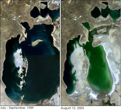
Aral photos from the Earth Observatory website